 Data Wrangler
Outrider corrals Teapot Dome
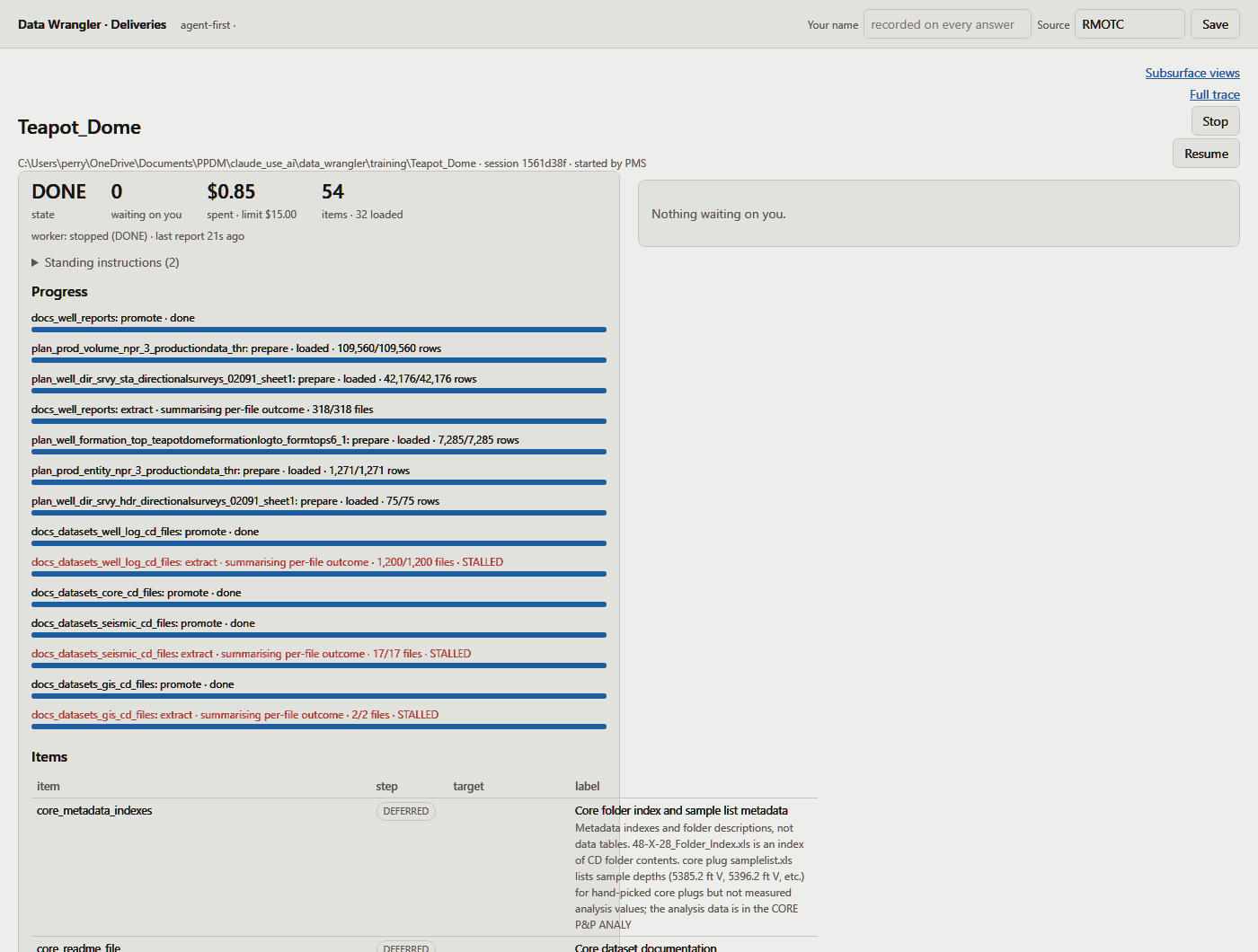
One delivery, scattered across a CD like a herd after a thunderstorm: well headers, production, directional surveys, formation tops, core, borehole images, seismic, logs, 208 photographs and 318 well reports. All of it into an empty database in 14 minutes 42 seconds for 85 cents — and in all that time it reined in exactly three times to ask somebody a question.
The coffee cost more than the load did.
How the Outrider rides
An outrider (Agentic Agent) goes out ahead of the herd, reads the country and comes back to report. The trail boss decides. That is the whole arrangement: the Outrider proposes, tested code rides fence, and a person settles anything that is a judgement rather than a step. Here is how that went, from the moment somebody pointed it at a folder.
-
Pointed at a directory
One folder and a spending limit, which is about as much of a briefing as a hired hand ever gets. Here: the Teapot Dome delivery, $15, and a note to keep the last 36 producing months of each well.
-
Rides the whole spread
Every file, every folder, right down into the corners — spreadsheets, LAS logs, SEG-Y, PDFs, Word documents, images, and a geodatabase that is really 639 files in a trench coat pretending to be one.
-
Works out which pen each one belongs in
A target table and a column-by-column mapping for every file and every sheet. Where that exact file and sheet was mapped before and a person approved it, the mapping is proposed straight away rather than worked out again.
-
Rides the fence line before anybody is bothered
The mapping is run against the whole file, writing nothing. Every source column must be read or listed as skipped with a reason. Values are measured against the columns they are headed for. Coordinates are checked against the place the row itself names, coded values against the lists they would have to join to, well identifiers against the wells that exist or are on their way. A plan that fails any of these never becomes a card — it goes back to be worked out again.
-
The trail boss says move 'em out
What survives that comes up as a card: the rows it would load, the columns it would fill, and the sample it read. Approve it, send it somewhere else, or refuse it. Nothing reaches the database before that card is settled.
-
Drives them in, one pass
Staged and committed in a single transaction, recorded against the person who approved the mapping. The testing above is why there is no second pass: the file has already been read and checked, so writing it twice — once to a trial, once for real — only meant reading the same spreadsheet again. The insert adds only rows that aren't already there, and anything that cannot land stays staged with its reason attached.
-
Mavericks go to the boss
A row with nowhere to hang is held, not guessed and not dropped. If the parent turns up later in the run, the row goes in by itself. If the delivery simply never says — which operator, which well, which survey — that is a card, and it waits.
-
And it hollers when it needs to know something
A value that argues with its neighbour, a folder it proposes to leave out, a sample of what it pulled out of a document. Every question carries its evidence, and every answer is signed and dated.
-
No stragglers left on the range
It cannot declare itself finished while a file in scope is unaccounted for. Every one is loaded, being loaded, or set aside with a reason in writing.
-
Tallied at the gate
The totals on this page are read back out of the database after the fact, not reported by the thing that did the loading.
When there's no pen to put it in
Sometimes a file holds something the database was never designed to hold. The Outrider's job there is to say so plainly instead of forcing it into the nearest table that half fits — because a value in the wrong column still plots, still exports, and still gets quoted. Three of the tables this run filled exist for exactly that reason, built when this delivery first met the database:
- 1dv_well_dip. Nine Schlumberger FMI workbooks for 48-X-28 — bedding, bed boundaries, inter-dune bedding, borehole dip and five kinds of fracture. 1,945 interpreted picks, and the database had no table for a dip at all. Keyed on the pick, not on depth: inter-dune bedding picks the same depth twice, and a depth key would have silently kept one of them.
- 2dv_reservoir_property. A sheet listing nine reservoirs as columns and 25 properties as rows. Three of those properties had a home; original oil and gas in place, porosity, permeability, net thickness, cumulative production, recovery process — the reason the sheet exists — had none.
- 3dv_strat_column. The field's geologic column: period, formation, member, thickness, typical depth. None of it belongs to a well, and every table that could have taken it is keyed by well. Loading field depths against a well would have invented an identity that isn't there.
Who decided the shape
A person did, all three times — the commit messages say so: “Perry chose a property table”, “Perry chose a table shaped like the thing itself”. The Outrider finds the homeless data and makes the case; the trail boss settles what the new table looks like; the table is built, and then the Outrider fills it. What it will not do is quietly invent a column and pour the data in.
Where the fourteen minutes went
For four and a half minutes it appears to be doing nothing at all. That is the part where it decides: 30 loads proposed, checked against the files and settled before a single row is written. Then the gate opens and 396,000 rows go through in a hundred and forty seconds — the wells, the production history, the survey stations, the formation tops and a quarter of a million seismic grid points.
The last eight minutes are 318 well report PDFs, read one at a time. No amount of remembering gets a man out of reading the mail.
Three mavericks
A maverick is an unbranded calf: nobody can tell you whose it is by looking at it. A delivery throws them up too — a row that needs a parent, and nothing anywhere in the files willing to say which one. The Outrider will not guess a brand. It reins in and asks. Three times, all morning.
-
Seven operators that match no company on file
1,315 wells name an operator. Seven of those names — U.S. DOE, Mammoth Production, Harpel John P Jr. among them — match nothing in the company records. Create them, point them at a company already there, or leave the field empty. A guess here hangs a thousand wells off the wrong outfit. answered: create all seven
-
208 core photographs with no brand on them
Each one records its interval, its tray and the date it was taken. Not one of them records the well it came out of. Ear tags all round and not a brand in sight. answered: 48-X-28
-
Five seismic lines that never gave a survey name
lineA through lineE, no survey name in any header. Without one there is nowhere for the survey or its lines to live. answered: NPR-3 2D
Who settled the other thirty-eight
41 cards came up. Three went to a person, and one more was a person's instruction relayed and labelled as relayed. The rest answered themselves, and every one of them says who and why.
- 27Plans already approved. Each carried the note “the same mapping was approved and loaded before for this layout”, tied to that exact file and sheet. A plan is never reused on a file it wasn't approved for.
- 8Standing rules. Value checks, sample checks, and folders Outrider proposed to set aside. Recorded against the rule and the person who switched it on.
- 2Answered by hand anyway. A ground elevation arguing with its kelly bushing, and a completion date in 1907. The rules would have taken both; the answers came by hand first.
- 1The map layers. All 137 of them, skipped on instruction.
What came through the gate
| Table | Rows | What it is |
|---|---|---|
| Wells and production | ||
| dv_well | 1,351 | Well headers, all inside the Teapot Dome field |
| dv_prod_entity | 1,264 | What produces |
| dv_prod_volume | 108,177 | Oil, gas and water, last 36 producing months per well |
| dv_business_associate | 7 | The operators from the card above |
| Down the hole | ||
| dv_well_dir_srvy_sta | 40,092 | Directional survey stations |
| dv_well_dir_srvy_hdr | 153 | Their survey headers |
| dv_well_formation_top | 7,405 | Formation tops |
| dv_well_dip | 1,945 | Borehole image dips: bedding, fractures, dune bedding |
| dv_well_log / dv_well_log_curve | 9,952 | LAS logs and their curves |
| dv_well_dst / dv_well_dst_period | 265 | Drill-stem tests and their flow periods |
| dv_well_casing | 106 | Casing strings |
| dv_well_stimulation | 144 | Stimulation treatments |
| dv_well_petro_zone / _interp | 127 | Petrophysical zones and interpretations |
| Core | ||
| dv_well_core | 13 | Cored intervals |
| dv_well_core_sample | 112 | Porosity and permeability by sample |
| dv_well_core_photo | 208 | Core photographs, filed against 48-X-28 |
| Seismic and the model | ||
| dv_seis_horizon_grid | 241,587 | The 3D horizon grid |
| dv_seis_horizon | 9 | Interpreted horizons |
| dv_seis_set / dv_seis_line | 8 | Two surveys, six lines — NPR-3 2D among them |
| dv_well_checkshot | 92 | Time–depth pairs |
| dv_reservoir / _property | 202 | Reservoirs and their measured properties |
| dv_strat_column | 30 | The stratigraphic column |
| 27 tables | 413,249 | counted from the database after the run |
Files and documents
Two different jobs. A data file is read: a spreadsheet, a LAS log, a SEG-Y volume, where the numbers sit in rows and columns and the work is knowing which column is which. A document is mined: 318 well report PDFs, read one at a time for the facts buried in the prose. By row count it is not a close contest.
That sliver is doing more than its width suggests, because rows are not the only measure. Six of the 27 tables were filled entirely from documents — drill-stem tests and their flow periods, casing strings, stimulation treatments, petrophysical zones and interpretations. Not one of those facts appears in a single spreadsheet anywhere in the delivery. The documents also contributed 1,101 directional survey stations, 326 formation tops and 80 survey headers alongside the spreadsheets that carried the rest.
What it read and left where it lay
The geodatabase on the Teapot Dome CD is a folder of 639 files. Outrider opened it and reported what was inside: 137 map layers — 2,694 oil pipeline segments, 1,897 roads, 1,451 faults, topographic contours, the NPR-3 boundary — each with a suggested home and a box to tick.
The verdict from the person holding the pen: “Nothing in the geodatabase is of much interest, but it is good that we can read it.” So all 137 were skipped, and the folder is filed as set aside with that reason rather than quietly forgotten. Reading something and choosing not to keep it are two different facts, and the database holds them apart.
Check the tally yourself
Every number here comes from the database after the run, or from a read-only recorder that sampled the live session once a minute and photographed each card as it appeared. The database started empty: no catalog, no registered codes, nothing carried over but the load plans a person had approved by name and date. All 41 cards keep their question, their answer, who answered and when — including the one a machine passed along on instruction, which is signed as relayed and not in anybody else's name.
Fourteen minutes, three questions, 413,249 rows, and not a single thing loaded that nobody agreed to.
The herd is in the corral, the tally book balances, and the Outrider rides off into the sunset without waiting to be thanked. Somebody always asks who that was.