 Data Wrangler
Outrider in Rooks County
A new outfit, a new range. The Kansas Geological Survey's public release for Rooks County: ten thousand well headers, fifty thousand formation tops, a log index, some six hundred LAS files, ninety-five well documents and a map of every well in the county. Different files, different column names, different ideas about what a well identifier looks like. All of it into an empty database in 11 minutes 48 seconds for 92 cents.
Kansas is flat. The data isn't.
The spread
One folder, handed over with a spending limit and three lines of instruction: it is all Rooks County, the KGS licence wants its credit line, and each well's KGS identifier goes in as an alias. Here is what was in it.
- rooks_wells.txt10,168 well headers, 43 columns, comma-separated text
- rooks_tops.txt51,827 formation tops
- rooks_las_index.txt644 rows listing the LAS files and the well each belongs to
- LAS\the logs themselves — 599 read
- Documents\ · 16 folders95 well documents: 90 PDFs and 5 TIFFs, most of them scans of paper from the 1940s onward
- GIS\rooks_county_wells.geojson10,169 well points for the map
Where the eleven minutes went
The table files go first and go fast: wells inside two and a quarter minutes, their KGS identifiers a minute and a half later, and fifty thousand formation tops by the five-minute mark. The tops waited for the wells on purpose. A top hangs off a well, so the Outrider will not drive the tops into the corral until the wells are in it.
The long flat stretch is reading. Ninety-five documents, folder by folder, then six hundred LAS files. None of it is waiting on a person.
A brand on every folder
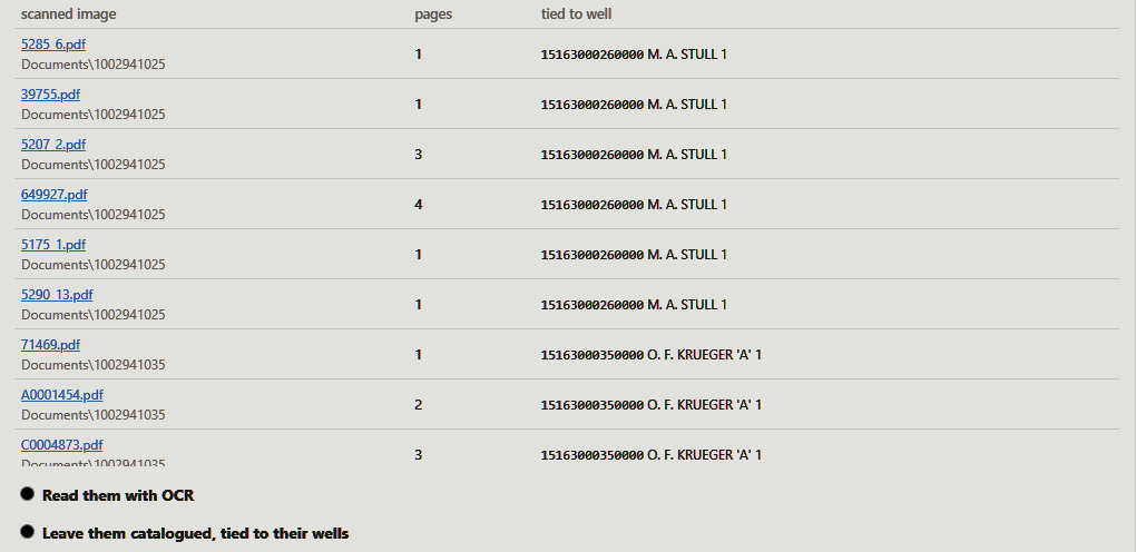
Most of the Rooks County documents are scans: completion reports, plugging records, drillers' logs, typed and stamped and signed, many of them eighty years old. No text layer. Getting a well out of one means OCR on a stamped API number, and on paper that old OCR reads it about as well as a cow reads a brand upside down.
It didn't need to. Every document folder is named with the well's KGS
identifier — Documents\1002941025 is M. A. Stull 1 — and
that identifier was loaded as an alias with the wells. So each folder's files were
tied to their well by the name on the folder: 94 documents to 16
wells, without reading a page of a scan. The ninety-fifth had typed text
in it and named its own well, Hinkhouse 19 — the same well its folder did.
Eight logs with a slipped digit
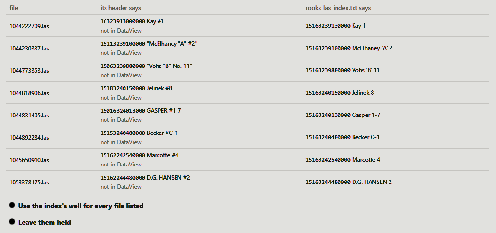
Eight LAS files carried a well number in their own header that is not a Rooks
County well. Jelinek #8 says it is 15-183-24015: county 183 is Smith
County. The log index in the same delivery lists that file against
15-163-24015, Jelinek 8, in Rooks. Same lease, same number, one
digit apart.
The mavericks
A maverick is an unbranded calf. Here, a value that has to join to something the database doesn't have yet — and nothing in the delivery to say what it is. The Outrider doesn't brand them itself. It asks.
-
566 operators with no company on file
Murfin Drilling Co., Ritchie Exploration, Inc. and 564 more. Each becomes a company with its full name kept, however long — “White Hawk Oil Company, a General Partnership” is 45 characters, and nothing gets trimmed. One of the 566 was the word unavailable, and that is not a company. 565 companies. answered: create them; leave "unavailable" blank
-
24 well statuses and 4 elevation datums nobody had registered
KGS's own codes —
OIL-P&A,D&A,OTHER-P&A(INJ or EOR);KB,GL,DF,TOPO. A load never makes up a code. A person registers it. answered: register them, KGS's codes as the codes
Two it had to be told
-
The log index, as directional surveys
The Outrider proposed loading the 644-row log index into survey headers, because it has a depth start and a depth stop. It is a list of files, not a survey. Refused, with the reason in writing. answered: reject — "a list of LAS files, not surveys"
-
So: set the index aside?
Its next proposal was the right one. The LAS files load on their own — and set aside is not thrown away: a few minutes later the index settled those eight logs. answered: agreed, set aside with that reason
Who settled the fifteen
- 13Standing orders from the trail boss. The trail boss wasn't in the saddle for this one. The answers were left behind, carried out, and signed PMS (relayed by Claude) — never in anybody's name but whose they were.
- 2The session rule. Twenty-two ground elevations that disagree with their kelly bushing by more than 500 feet, loaded blank rather than wrong; and the one sample check on what was read from the documents.
What came through the gate
| Table | Rows | What it is |
|---|---|---|
| Wells | ||
| dv_well | 10,168 | Every well header in the county file |
| dv_well_alias | 10,168 | Each well's KGS identifier — what ties the document folders |
| dv_well_formation_top | 50,468 | Formation tops: 50,466 from the tops file, 2 read from a completion form |
| Logs | ||
| dv_well_log | 560 | LAS logs, 8 of them settled by the index |
| dv_well_log_curve | 9,152 | Their curves |
| 5 tables | 80,516 | counted from the database after the run |
| And the parents they hang from | ||
| dv_business_associate | 565 | Operators, new |
| dv_spatial_layer | 1 | Rooks County wells, as a map layer |
What the documents look like
Two of the six documents for M. A. Stull 1, both from 1944, both scans with no text layer.
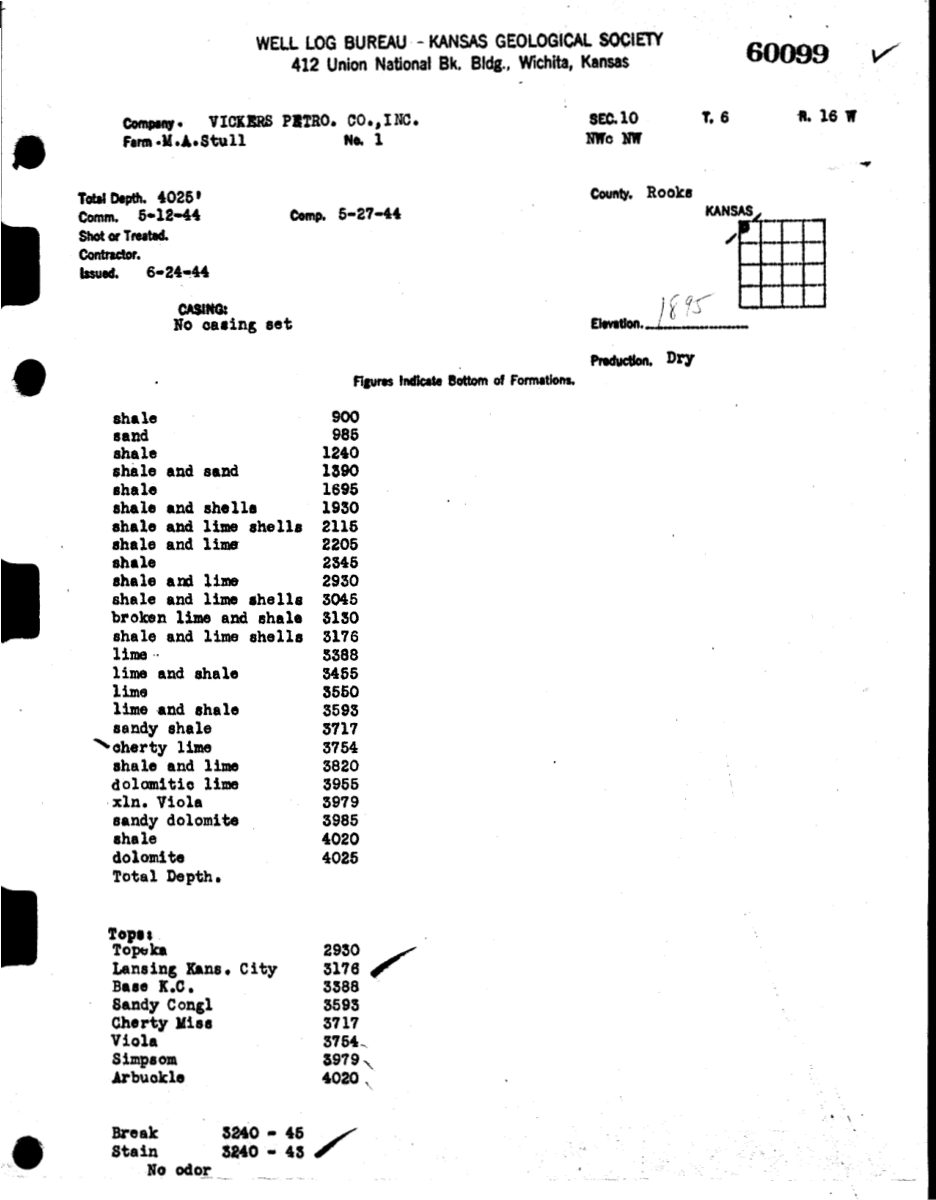
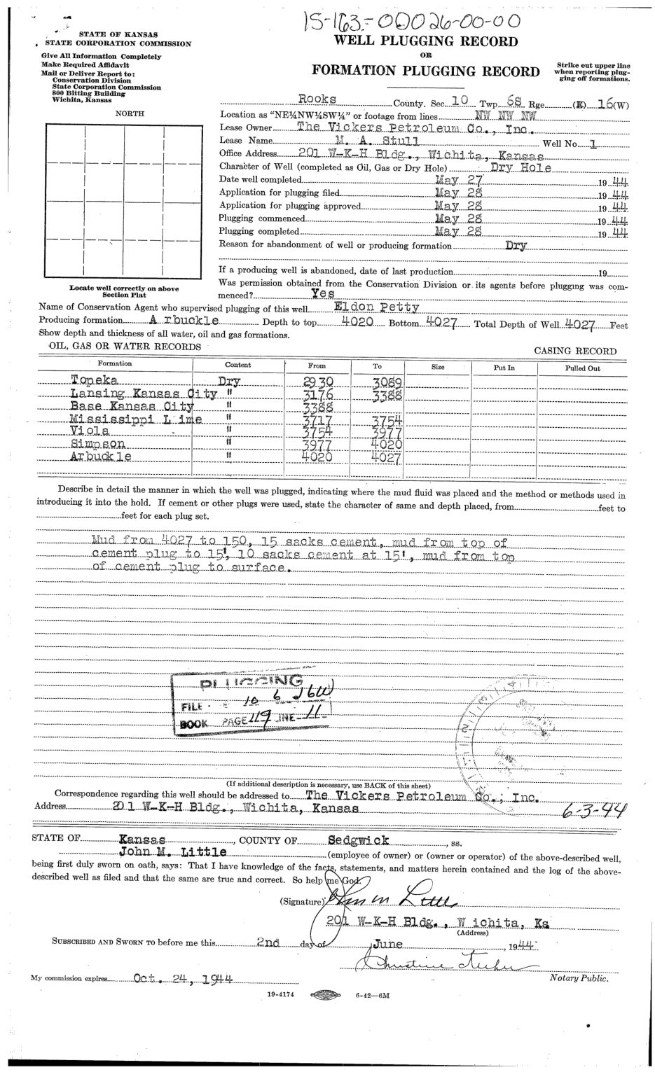
What these needed was not to be mined but to be found: every one of the 95 now answers to its well, so ask for M. A. Stull 1's documents and all six come back — the well log bureau's log, the plugging record, the conservation agent's report. No rows, and the part a geologist actually asks for.

Check the tally yourself
The database started empty: no wells, no catalog, no plans for these files. It
carried one thing in from before — a list of column names it had seen mean
the same thing elsewhere, so that API_NUM_NODASH could be read as a
well identifier without anybody working it out again. Every number on this page
comes from the database after the run, or from a read-only recorder that watched
the live session. All fifteen cards keep their question, their answer, who
answered and when.
The source of this material is the Kansas Geological Survey website.
Eleven minutes, 80,516 rows, ninety-five documents home to their wells, and not one page OCR'd to get them there.
The Outrider rides off across the flat country. There is a lot of Kansas left, and it has 104 more counties to go if anybody asks.